The New Zealand South Island is filled with parks and natural beauty. It is far less populated than the New Zealand North Island with many outdoor attractions and activities. Several regions make up the South Island and reaching them takes time however you may travel.


Nelson/Tasman Region
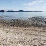
- Te Waikoropupū Springs (Pupu Springs): The Tākaka area of Golden Bay, New Zealand is the largest cold-water springs in the Southern Hemisphere and is some of the clearest water ever recorded. The looped trail is a mixture of gravel and boardwalk (1.5 km, 35 minutes). Many birds and native plants are seen along the short trail from the parking lot. There is also a large public bathroom but no grab-bars. The town of Tākaka is home to many artists, and a great place to get something to eat, use a toilet and to stroll around.
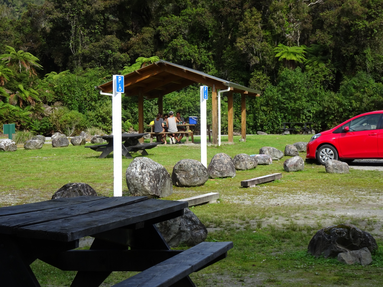
- Pelorus Bridge Scenic Reserve: Three trails are here that may be of interest. Tawa Path (1 km, 30 minutes) is a gentle looped trail consisting of gravel and boardwalk through a shady forest; the trailhead is near the café. The Tōtara Path (800 m, 20 mins) is a one-way gravel trail with a few gentle slopes through a shady forest; the trailhead is at the picnic area. The Circle Walk (815 m, 20 minutes) is a gravel path that begins at the river and ends at an overlook near at the suspension bridge, and there is no access beyond the bridge.
- Nelson Lakes National Park: Bellbird Walk at Lake Rotoiti is the most wheelchair friendly trail at this park. It’s a short, 620m gravel trail that takes about 15 minutes to loop around. Bellbird Walk begins at the parking lot at Kerr Bay in St. Arnaud. A few other trails take off from this one, so there’s more to possibly explore.
- Kahurangi National Park: Riuwaka Resurgence is a 10 minute, one-way trail to the cave entrance where the river emerges from Takaka Hill, called the Crystal Pool.
- Mapua Wharf: Not far from Nelson, this scenic beach town is a place to chill. In addition to some art galleries and restaurants, the Mapua Wharf is an accessible spot to watch boats and people jumping off the wharf. If in the mood for ice cream, try Hamish’s for some real fruit ice cream. A wheelchair friendly toilet is also found at the wharf.
- Kaiteriteri: A small beach town with a boardwalk along the sand.
- Wine and Beer Tasting: This region boasts a number of award-winning wineries and breweries that are open for tasting. Neudorf Vineyards is one of the biggest and most popular to visit.
Marlborough Region
- Kaikoura Peninsula Walkway in Limestone Bay (600 m, 15 minutes): Kaikoura is where you can go Albatross watching. It’s located about 2.5 hours north from Christchurch right along the coast. The short, one-way paved path begins at the South Bay parking lot in Limestone Bay. Informative panels explain the natural surroundings. An accessible public toilet is also located here.
Canterbury Region
- Ōtukaikino Walk (1.2 km, 35 mins): This loop trail begins at the parking lot and travels around a freshwater wetland with many spots to sit along the way. Surface of the track is gravel, dirt and boardwalk. There is a designated place for picnicking, and the toilet is wheelchair accessible.
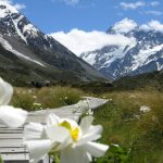
- Hooker Valley Walk at Aoraki Mt. Cook National Park (1.8 km, 30 minutes): This one-way trail is partially accessible to the first overlook and bridge, and begins at the White Horse Hill Campgrounds. The surface is practically flat and firm with gravel on top. This is a great trail for views of the Southern Alps on a clear day, Mueller Glacier and Hooker Lake. Toilets are located at the Mt. Cook Village; the one at the trailhead isn’t wheelchair friendly.
- Hanmer Springs is a resort town in the Canterbury region of New Zealand’s South Island (near Christchurch). It’s known for Hanmer Springs Thermal Pools and Spa, with its mineral waters. It is one of the few places with equipment to assist people who cannot walk or stand in and out of the water.


Westlands Region
Greymouth Area
- Punakaiki Pancake Rocks and Blowholes Walk (30 minutes, 1.8km): A loop walk on a paved pathway to Dolomite Point where you can see limestone landscape of pancake-shaped rock formations, blowholes and surge pools. Overlooks and viewing platforms are along the trail, which consists of loose and paved gravel. A side trail is not wheelchair friendly, and has a warning sign at the start.
- Nelson Creek Walks: This area has a few short trails, so with plenty to do, people may say 20 minutes or 1.5 hours (900m – 2km). Of all the trails, the most accessible is the Colls Dam Walk. (2.45 hours north of Franz Joseph.)
- Hokitika Gorge Walk: From the parking lot, follow the short path through the dense forest to the first viewing platform, which is wheelchair friendly (before the swing bridge). Here you can see the Hokitika Gorge and lush farmland. (2 hours from Franz Joseph.)
- Cape Foulwind Walkway: Located along the Tauranga Bay near Westport, the Cape Foulwind Walkway takes people along the coast near a lighthouse to a seal colony; the most active time for the seals is November to January. The one-way trail’s makeup is firm, and a combination of packed dirt and gravel, asphalt and wooden boardwalk. From the parking lot the track is about 15 minutes long (500m) to the viewing area. (3.5 hours north of Franz Joseph.)
Fox Glacier Area
- Lake Matheson: (2.4 km, 45-60 minutes). This one-way trail is most known for reflective views of Mount Cook and Mount Tasman. Accessible parking is right in front of the café, which is next to a gift shop, and another three spots are located nearby with a connecting boardwalk. Both buildings are accessible by wheelchair and there is a toilet inside the café. Flooding happens with continual rain and dries out quickly. The trailhead is around the corner from the café patio; follow the signs. The trail itself is firm with overlaying gravel and debris and a number of embedded medium-sized rocks. The start of the trail is 6+ feet wide, then narrows to about 4-4.5 feet wide, and occasionally opens up further. A wheelchair with power assistance will complete the trail faster. As the trail narrows it makes it harder for people to pass, but not impossible, even for larger wheelchairs. When the trail forks, veer right towards the meadow of tall grasses to the Jetty Lookout to see a magnificent view of mountains reflecting in the water.
- Peak View Point is located just past the entrance to Lake Matheson. The viewpoint is a short 2 minutes from the road. There is also a picnic area.
- Minnehaha Walk (1.35km, looped): A short trail that follows a stream in the Glacier Country rainforest with glowworm sightings at night. On average, the trail takes about 25 minutes to complete. The surface of trail has a few uneven spots, but overall is very flat, and is made up of gravel and boardwalks.
- Te Weheka Walkway/Cycleway (2.1km, 1.2 hours, one-way): This paved trail starts near the Bella Vista Motel on the edge of town and ends at an Fox Glacier overlook. This track is a flat, gravel path that intersects with the Minnehehe Walk.
- Moraine Walk (1km, 20 minutes, one-way): A rocky, one-way trail on the south side of the Fox Glacier township through native brush. The track starts on earth thousands of years old, which is fairly level ground, and then climbs gradually upwards, which was unsafe to do in a manual wheelchair alone. Even after this ascend, this track becomes increasingly unstable for wheelchair.


")
")


Franz Josef Area
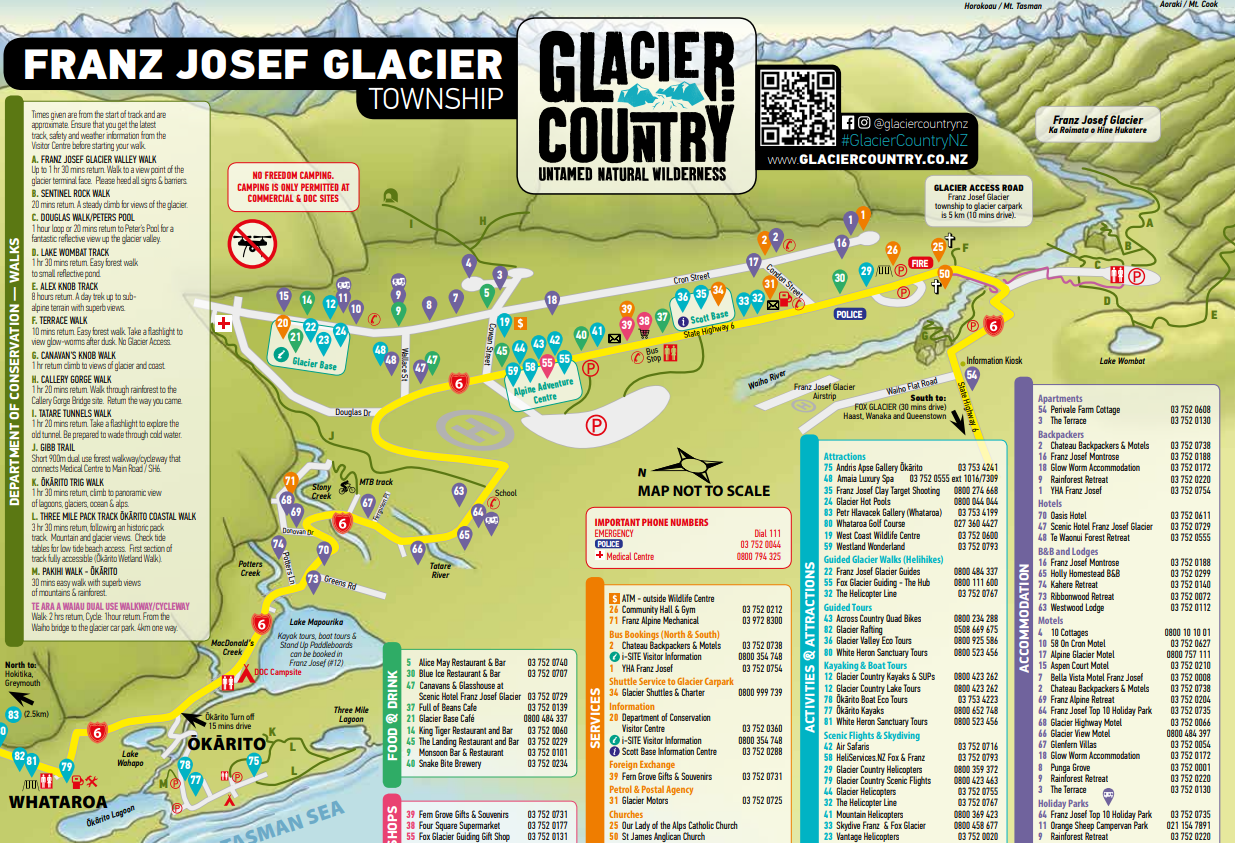
The small town of Franz Josef Glacier has a few shops, places to eat, public toilets, a gas station, and businesses offering adventure tours. The Blue Ice Café was a favorite place and on the end of the main road where it’s less congested. Otherwise, visitors will find Chinese, American and some Italian food options. This Franz Josef Glacier Map has restaurants as well as hiking trails and attractions.
- Franz Josef Glacier Hot Pools are also in this downtown area, located right off the main road. The ticketing area has small coffee shop with snacks and beverages. There is a roll-in shower, toilet with grab-bars and the changing room is barrier-free. Pathways to the hot springs are all paved. An accessible lift or hoist to get in and out of the water wasn’t an available option, but if you can make it work, it’s worth it. Surrounding the outdoor pools are lushest green ferns and plants, and a canopy blocks sunlight and heavy rain. Rain made the experience better, in my opinion.
- Te Koha Gallery: There is a local lady that runs a rock carving art gallery and studio workshop. She has pieces of Aotea and Jade stone that you can carve into something unique to take away with you. Aotea is unique to South Westland NZ, comprising of Kyanite (blue) Fuchsite (green) and Quartz (white) energetically Aotea carries the Essence of The Devine a Feminine Energy.”
- Helicopter Tours: On the main road (Highway 6) in Franz Joseph Glacier, are many helicopter tours, some even take people on hikes. Since that wasn’t in the cards, I choose to do a short tour that included landing on the glacier with The Helicopter Line. There’s no official equipment to get people with limited mobility in and out of the helicopter, but it’s possible to be lifted in with assistance.
- ATV Quad Bike Tours: Across Country Quad Bikes is an unforgettable adventure and a rigorous workout. The ticket office is in the main center of town, and then riders stroll across the road to where the ATV bikes are kept. A simple course is already setup to test diving skills before the official adventure begins. The main tour guide directs from the front, and one other stays behind the last driver for safety. The tour first takes people through a thick rainforest with puddles to splash through. Then the track opens up to the rocky glacier shoreline, then travels upriver for epic glacier views before turning around and heading back on a different path. I was confident in my abilities and strength to do the ride, as I’ve done a few, but this was certainly the most challenging one yet. The size of the rocks would traverse the ATV at an angle that constantly pushed my foot and leg off and away from the side. I had to stop many times to reposition myself.
- Clay Target Shooting: A supplies and gear are provided. The location has a shelter to keep dry and/or out of the sun.
- Wild Life Center for kiwis gets attention with a ton of advertisements, flags and signs. The small, interactive museum is well done, but there is no wheelchair access to the kiwi viewing area due to a staircase. This is the main selling point for museum admission, so basically, spend your money and time elsewhere. The museum has a large gift shop, a large modified toilet, and also sells snacks and beverages.
- Franz Josef Glacier Overlook: Highway 6 travels over the river and splits, so veer left to get closer to the glacier. From the river and road, Franz Josef Glacier can be easily seen, which makes it one of the most accessible glaciers in the world. This road eventually ends at a parking lot where the glacier can still be seen.
- Terrace Walk (1.8km, one-way, 15 minutes): Located on the edge of town, before crossing over the bridge, and it is a great way to explore the local rainforest. The Terrace Walk is short and doesn’t take long to complete, which makes it a good track for children. Go during the day for lush green plants, and take a flashlight at night to see glowworms. No designated parking provided, so park where you can.
- Te Ara a Waiau Walkway/Cycleway (8.7km, one-way, 2+ hours): A paved asphalt, pathway crosses the Waiho Bridge from the town of Franz Josef Glacier, and runs along the river for a while, then turns to gravel as it meanders through the green brush before ending at the parking lot for Franz Josef Glacier.
- Douglas Walk/Peter’s Pool (1 km, one-way, 25 minutes): The path is wide and smooth with a asphalt surface. Grades are moderate but it is not a level path by any means. At Peter’s pool the view of the Glacier is distant but spectacular and if it is calm it is reflected in the pool. There is a large boardwalk platform at the pool offer a great view but the best reflection is seen from the furthest right-hand corner. Care does need to be exercised along the path however as it is cambered sharply on both edges.
- Franz Josef Glacier Valley Walk (1.2km, 30 minutes, one-way): This track is wide and relatively flat until a sizable downhill slope, and is barrier-free to the river bank where there is a view of the glacier. Those with a manual wheelchair will likely need assistance to complete entire trail. This track gets very hazardous and unsafe for hikers due to flooding, ice and rock slides, so pay close attention to signs and closures.
- Canvan’s Knob Walk (800m, 25 minutes, one-way): Goes along a the Waiho River before climbing up rocks. Though extra rocky, some wheelchair users will still be able to hike this track before it ascends.
- Sentinel Rock Walk (500m, 10 minutes, one-way): A short rocky trail that’s relatively flat for a little while, until it climbs significantly up rocks to a viewing area accessed only by stairs. It’s possible for wheelchair hikers to go tracking along flat section.
- Tasman Sea (Bruce Bay): Bruce Bay is a great place for views of the Tasman Sea along Highway 6. Commonly at Bruce Bay, a portable café sets up to serve beverages, ice cream, snacks, and a few food items. Eat in your car with a view of the bay.
- Ōkārito Wetland Walk (1km, 20 minutes, one-way): Has a museum. The trailhead is located at the Ōkārito School House and begins going through brush before turning into a boardwalk. The trail slightly climbs upwards to an overlook of the estuary. The lagoon is home to more than 75 native birds, including the kōtuku/white heron and royal spoonbills.
- Waitangi-Taona Wetland Walk (1km, 20 minutes, semi-loop): Home to many native birds, this easy tracking trail has views of the Waitangitaona Wetland and Southern Alps Kā Tiritiri o te Moana. This flat track begins as gravel and then becomes a boardwalk with many information panels and a few benches along the way. On the other side of the road, is where the White Heron Tours are located, but are not accessible. The tour is not suitable for wheelchairs around the boat landings, and the tour requires hiking a kilometer of soft track through the rainforest to get to the view the nesting site.
- Lake Mapourika: Jetty Bay is a good stopping spot at Lake Mapourika, the largest lake in Westland Tai Poutini National Park formed by flow from the Franz Josef Glacier. It’s a lovely recreational area perfect for picnicking, fishing, kayaking, and swimming. A dock allows people to get further out onto the water. Salmon season is October 1 to March 31, and trout can be caught year-round (fishing license can be purchased at Franz Joseph Glacier Motors). A wheelchair accessible toilet and picnic table with an extended end are onsite. No designated parking spot at this location.
- McDonald’s Creek: An area used for camping and day visits right along the creek. The ground is firm and rocky, but it’s possible to get close to the water. A covered picnic area has a few tables. A few designated parking spots are available as well as accessible public toilets.
- Lake Wahapo: Beautiful at sunset to take pictures with Mt. Adams reflecting in the distance. Salmon and trout are fished here. No access to report.
- Gibb Trail: (800m, 40 minutes, one-way trail): This short, flat track connects the Medical Center to the main road (State Highway 6). It’s a functional, rocky trail that appears on the official tourist map.


Otago Region
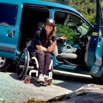
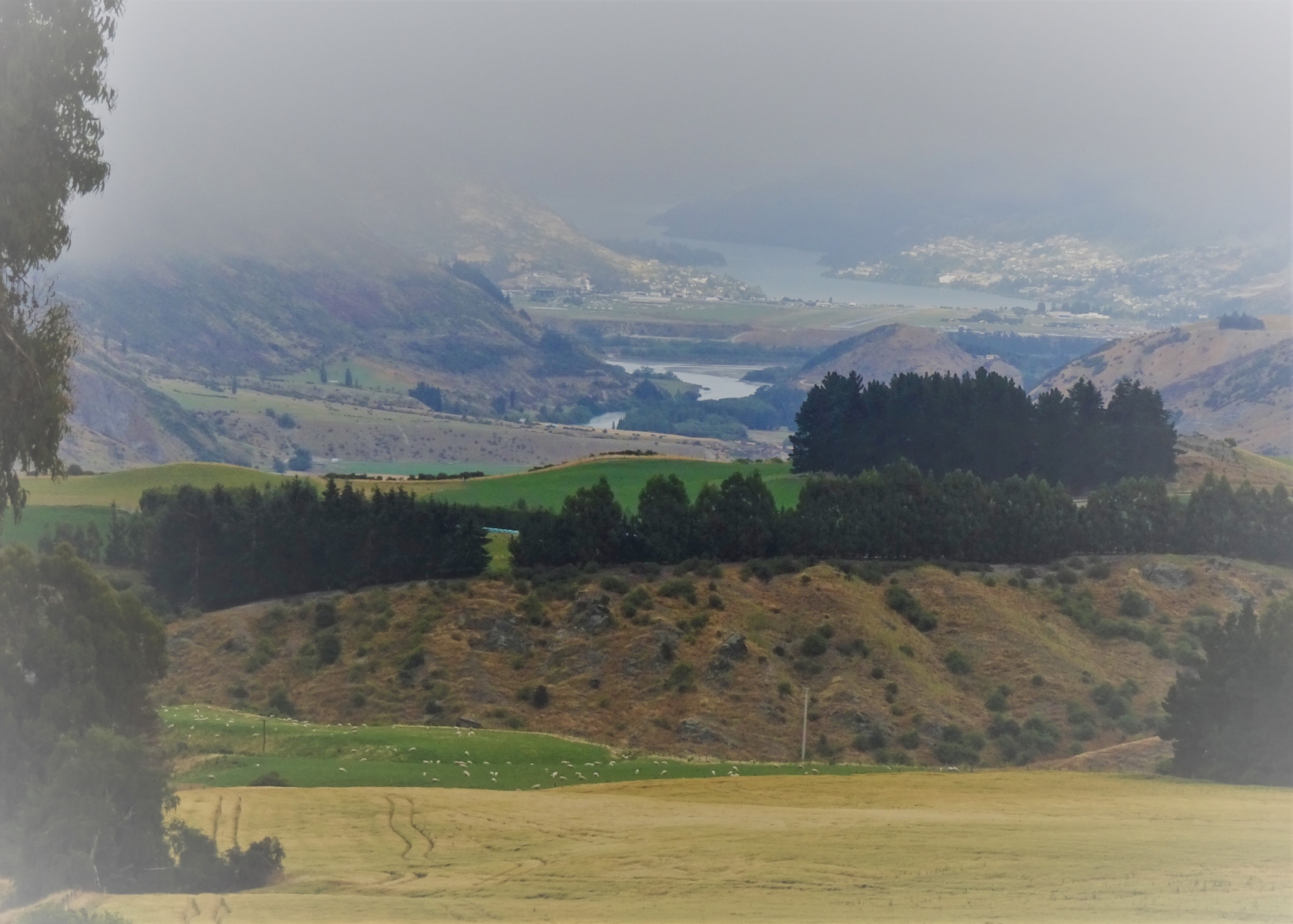
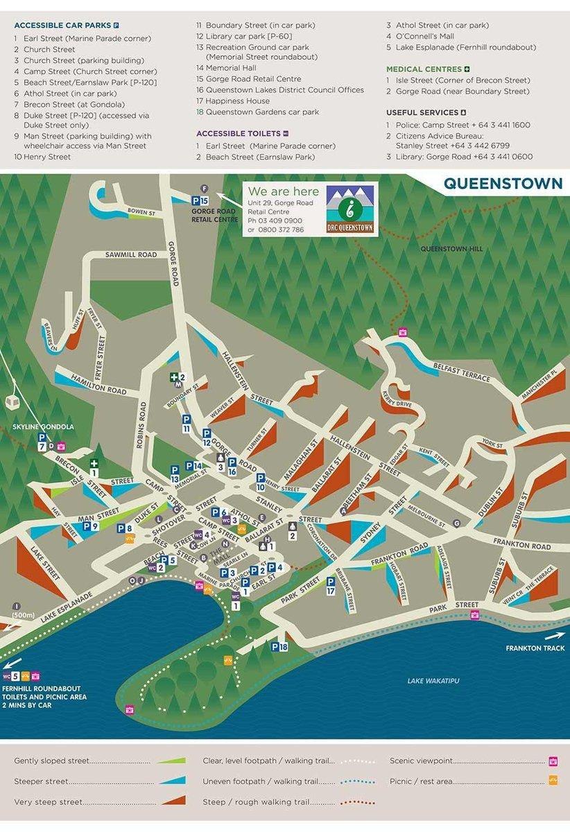
Queenstown is a lovely picturesque city on Lake Wakatipu, in the Otago Region of New Zealand, surrounded by mountains. Queenstown is also one of the most populated areas on South Island with many places to stay and dine, along with an international airport. A number of organized tours operate out of Queenstown and provide a variety of ways to explore the surrounding natural environment, like the Milford Sound. Wheelchair accessible vehicles are for rent with Freedom Mobility, and mobility equipment, including scooters and wheelchairs may be rented through Moving On Mobility Service.
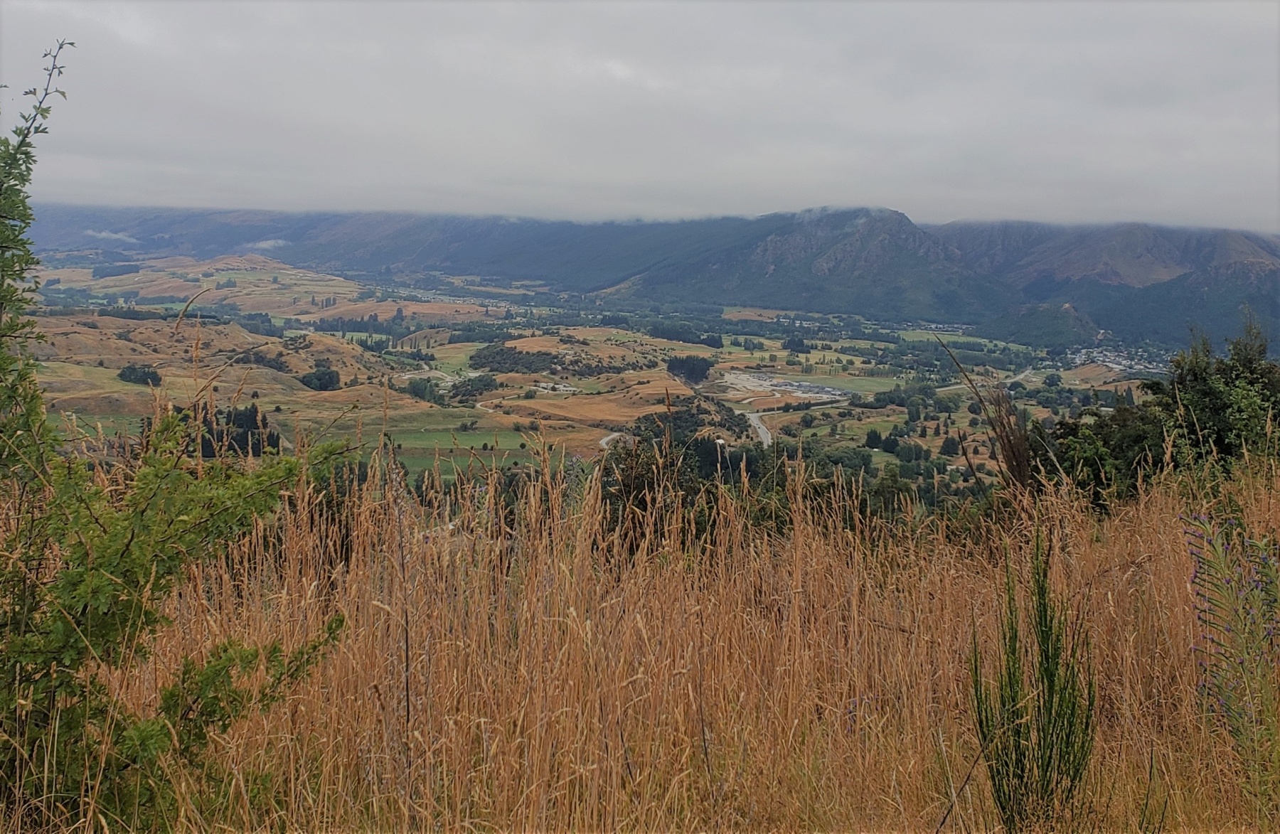
- Small Town Explorations: Cromwell is a small cute farm town (fruit basket of the capitol), about 50 minutes from Queenstown. Near Queenstown is Arrowtown, which has less tourist and hype and is a gold mining town. Wanaka is a great day-trip 1.5 hours from Queenstown. The cute town has many shops and places to eat and drink. Lake Wanaka is must with a smoothly, paved walkway around the lake, accessible public toilets and designated parking.
- Mount Aspiring National Park is near Wanaka with access to some outdoor attractions. Before reaching Haast on Highway 6, Thunder Creek Falls has a short (220m), accessible pathway that takes about 5mins-long on a sealed, paved surface. Along the Haast River, there is a 1.5km gravel track that takes about 30 minutes long and gently slope up to an overlook of Roaring Billy Falls. At the Pleasant Flat rest stop and campground, there is a view of Mt. Hooker, and a 5 minute forest walk along a stream that begins at the parking area; accessible toilet too. Fantail Falls (5 minutes, one-way) is a short, paved (sealed) trail to the base of the falls from the parking area; it’s a site that gets a lot of traffic. Cameron Look Walk (1km, 25mins, one-way) is a trail that lightly climbs to an overlook (made of wood and with handrails) of Makarora Valley; the surface is packed dirt and gravel. Another popular site is the Blue Pools Walk, not far from the Cameron Flat camping, and has one-way, barrier-fee wheelchair access to the first swing bridge overlooking the Makarora River. Makarora Bush is a looped walk through a silver beech and podcarp forest on a barrier-free, dense, gravel trail with a few small inclines; no designated parking.
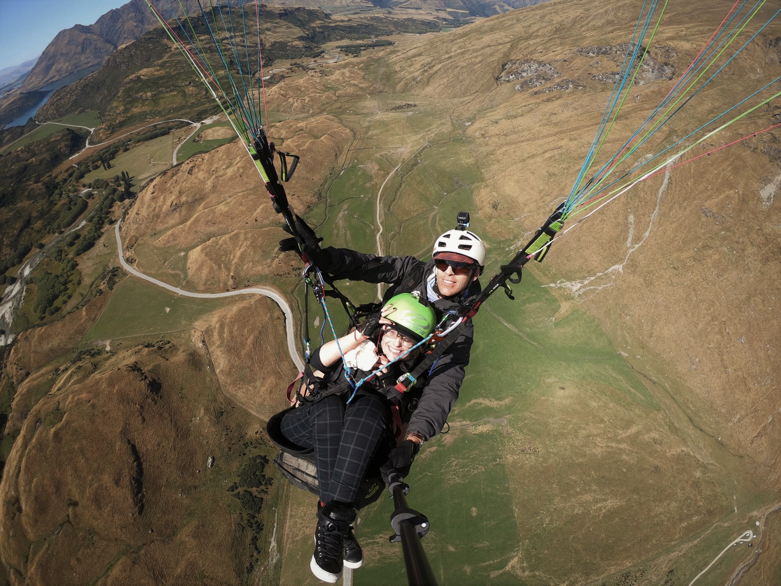
- Paragliding: For an unforgettable view of the Lake Wanaka, the adventurous traveler must try Wanaka Paragliding, located on the hillsides overlooking the lake. These people are pristine professionals who know what they are doing and have flown with people who have disabilities numerous times. Definitely give them plenty notice so everyone can plan properly. The launch site has no amenities, including an accessible toilet, besides a canopy for shade, so come prepared. The closest accessible toilet is located fifteen minutes away at the Glendhu Bay Motor Camp, which is a lakeside holiday park with accessible overnight options too. Otherwise, the public toilet along Lake Wanaka is the best option.
- The Jet Boat Tour is also near Queenstown, which takes riders through the Shotover Canyon. It is possible to get to the boat with assistance over some small rocks and then lifted into the boat; manual wheelchairs only for obvious reasons.
- J. Hackett Bungy Jump allows people to fly over the Kawarau River, and this activity is officially classified as wheelchair accessible.
- Dart River Jet Safaris offers three safaris, the Wilderness Safari, Jet Boat Safari, and Funyak Safari, and of these options, the Jet Boat Safari may be possible for some people who use a portable wheelchair. There is a 45-minute bus ride to Glenorchy, and you must be able to transfer out of a wheelchair and have it stored. The office at Glenorchy has an accessible toilet. There is a short minibus ride from the office to the boat ramp. Again, you must be able to transfer out of your chair. The best seating position is near the front as the aisle width on the boat is very narrow which makes it difficult if you need to be carried. The jet boat stops for about half an hour and you have the option of getting off the boat. This is achievable with the assistance of others, however, be aware that the ground can be very soft and possibly unsuitable for wheelchairs in places if there has been recent rain.
- Royal Albatross Centre is located on the southeast coast near Dunedin, about four and half hours away from Queenstown. In addition to accessible parking and toilets, the center has barrier-free access to displays as well as two scooters for use, first-come-first-serve. Booking a tour is required to see the nesting albatrosses, more commonly seen between late September to mid-November, there are no self-guided tours.
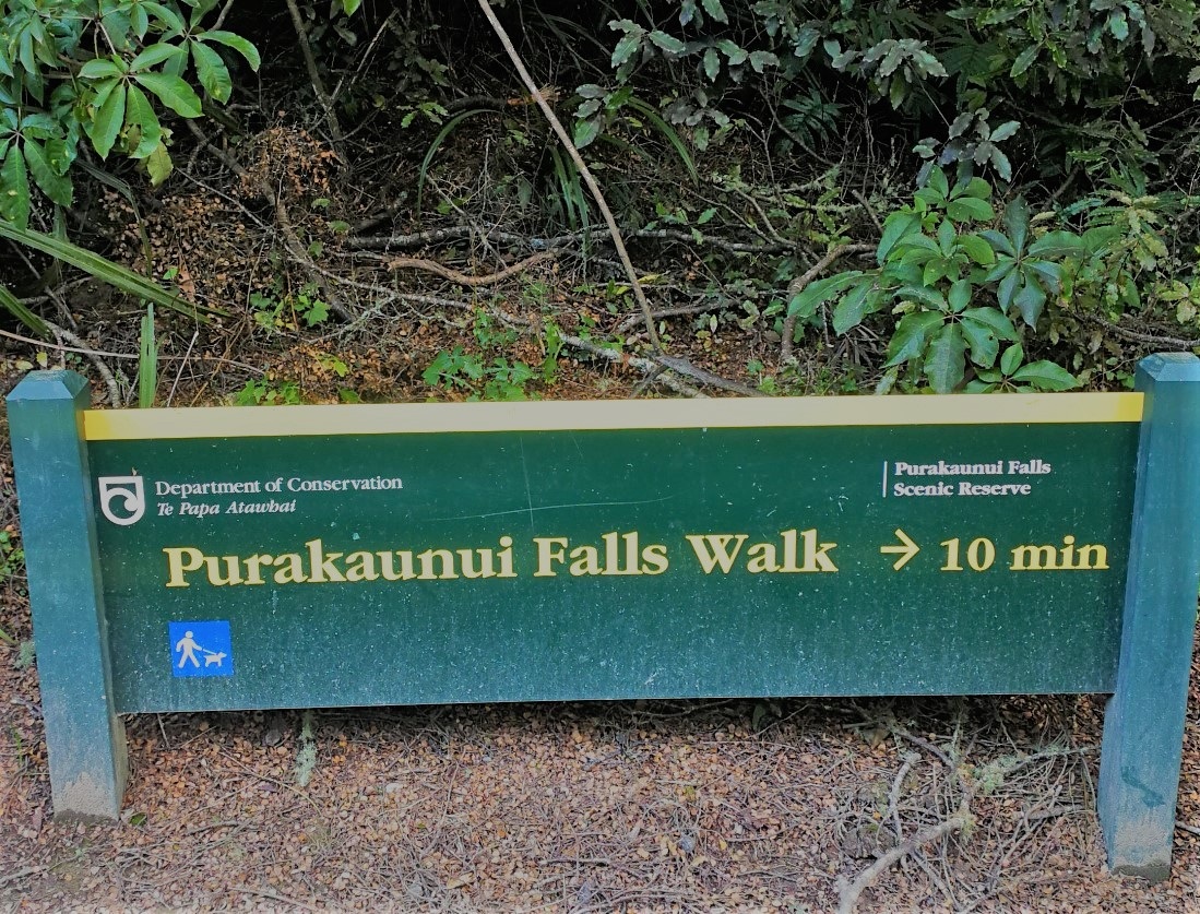
- Purakaunui Falls Walk, Catlins (750m, 20 minutes, one-way): Located along the Papatowai Highway, two hours from Dunedin, in the deep south-east of the Otago region, Purakauni Falls is one of the most photographed attractions in New Zealand. Made up of dirt and packed gravel, this trail is barrier-free for wheelchair users to reach the top viewing platform. This outdoor site has designated parking, toilets and a picnic area.


Southland Region
Te Anau
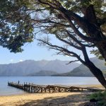
With a population of a couple thousand and surrounded by farmlands, Te Anau, New Zealand is considered the gateway to the Fiordland National Park and Milford Sound. The city of Te Anau is the largest developed area in this region, with a population of about two thousand, making it a popular last stop while traveling around the South Island of New Zealand. A variety of accommodations are available in Te Anau. The Radford Inn by the Lake is wheelchair friendly with a roll-in shower, and right across from Lake Te Anau. A smooth, paved trail runs along Lake Te Anau, which is exceptionally lovely in the morning and evening.
The small downtown area is flat and near the lake and by Lion’s Park. The National Park Visitor Center is on the lake right at the start of everything, A number of restaurants, eateries and cafés are located here, like the Redcliff Café, including a variety of different Asian cuisines, as well as a grocery store and Miles Better Pies and More. Strategically, gift shop stores sell items from New Zealand’s other regions, but with a clear, for-profit markup. Still, it’s visitors often last chance to get specialty items from all over New Zealand before returning home.
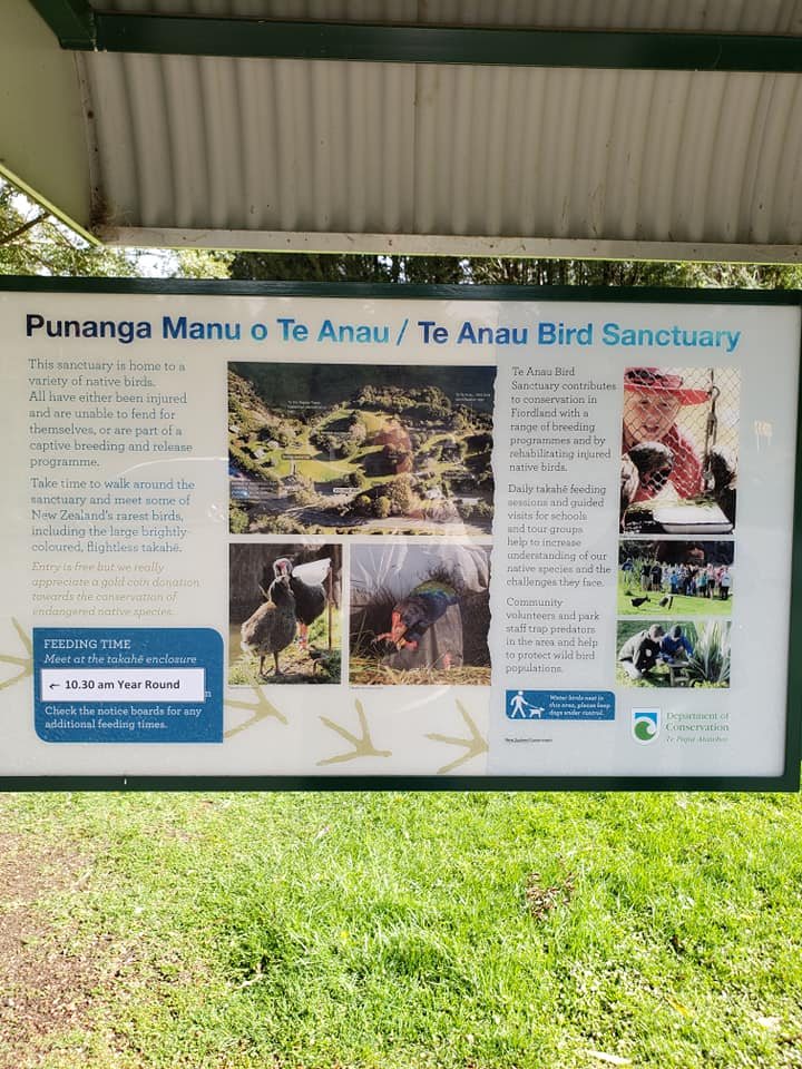
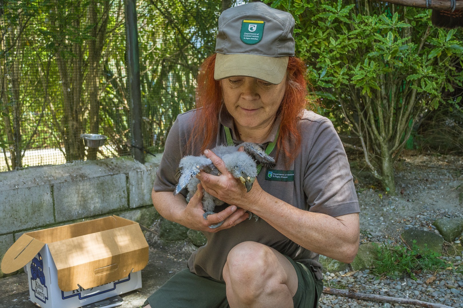
- The Bird Sanctuary is right on Lake Te Anau and is free to visit between sunrise and sunset. The trail is firm, and is easily oversaturated in heavy rains. A few different bird species are seen from the Fiordland region, the stars being the prehistoric Takahē. Guided tours are possible if booked in advanced at the Fiordland National Park Visitor Center.
- McCracken’s Rest is a lovely overlook of the southern coast on Te Waewae Bay and the tiny one million-year-old Solander Islands. This rest area is a perfect stopping point while road tripping in New Zealand, and you may even get to see a pd of dolphins.
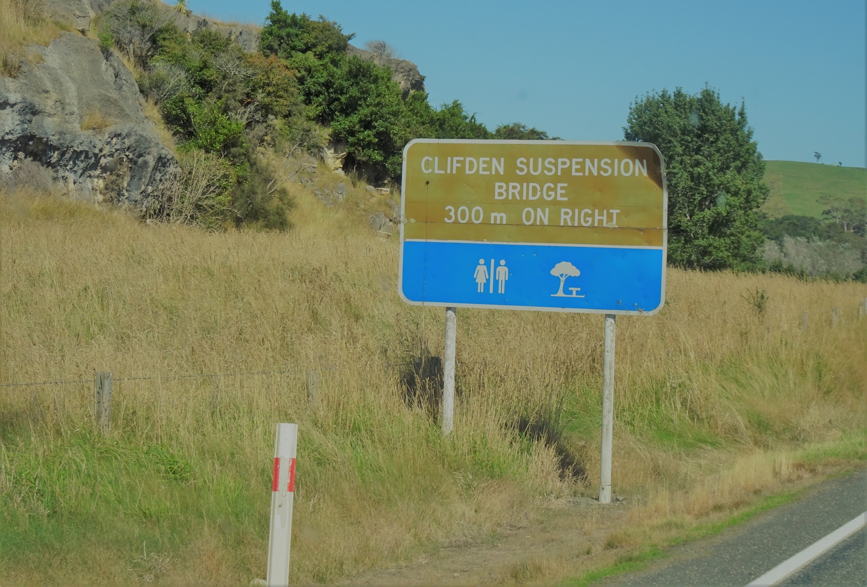
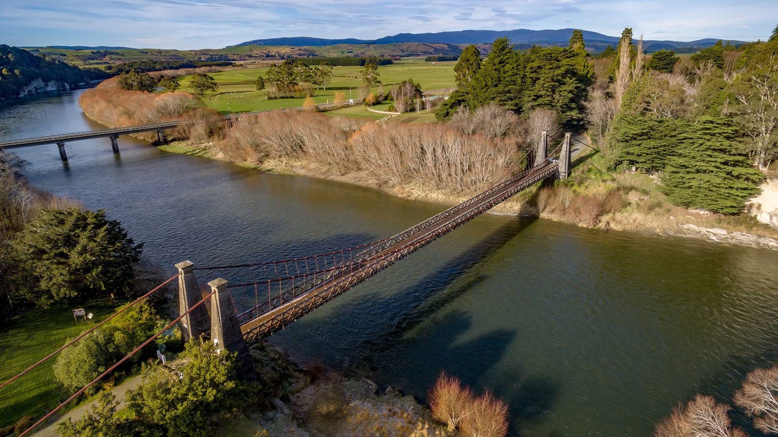
- Clifden Suspension Bridge, built in 1898, is a landmark that was once a vital transportation link to access the remote part of Southland, New Zealand and the longest suspension bridge in the country. From the parking area, it’s a short stroll on a paved walkway to the bridge, which is also smooth and wheelchair friendly to roll over. At this attraction is a small coffee shop, along with a large accessible restroom and designated parking.
- Doubtful Sound Tours from Te Anau or Lake Manapouri are not wheelchair accessible due to steps on buses and boats.


Fiordland National Park
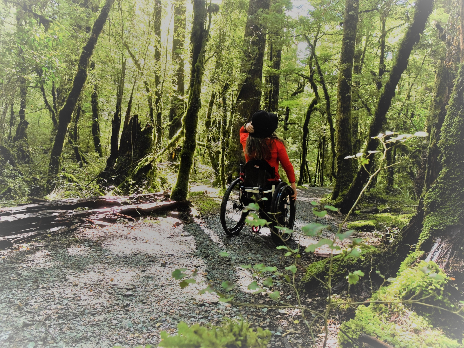
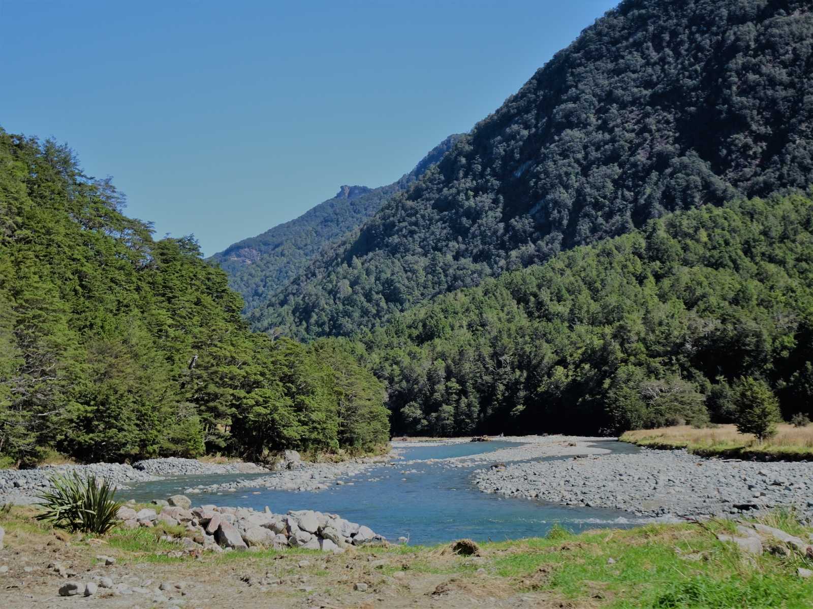
The Milford Highway drive to and through Fiordland National Park in New Zealand is spectacular, and the morning and afternoon sunlight are particularly gorgeous. The Milford Sound is at the end of the park and requires special driving permits to enter, but even before this point, there is much to see. First take notice of the giant trees towering over the landscape, like guardians of the forest. These Rimu trees may be fifty meters tall, and some existed before the world’s continent separated. See the powerful turquoise stream of the Eglinton River that runs along the highway, poking in and out of the trees. Gaze at the surrounding cascading mountains, their peaks, their shadows, their hidden water falls.
- Lake Mistletoe (1.3km, 50 minutes, one-way): This firm trail first goes through a wooded forest before gradually slopping down to Lake Mistletoe. The trail is wide and barrier-free. Due to the grade, cross-slope and length of trail, it’s advisable that manual wheelchair bring assistance to complete; a power wheelchair will do fine, but not suitable for a scooter.
- Eglinton Valley Overlook: The first main overlook at Fiordland National Park. The view is terrific in the car, but even better outside. Park wherever you can and stroll a few feet on the firmly packed gravel path into the meadow and read about the surrounding valley.
- Mirror Lakes (400m, 10 minutes, one-way): A must-stop for reflections of the Earl Mountains, located right off the Milford Highway, and an easy hike for children. Park along the road near the entrance because there’s no designated wheelchair parking, and take the ramp up from the road to the trailhead and informational panels. This area is paved asphalt and trail itself is a boardwalk with handrails on each side. This track gently takes visitors down to a viewing platform close to the water. This outdoor attraction is incredibly popular, especially for tours headed to Milford Sound, so plan for crowds and the possibility that a vehicle may be blocking access to the ramp; early mornings or before the park closes are the quietest and recommended for visiting times.
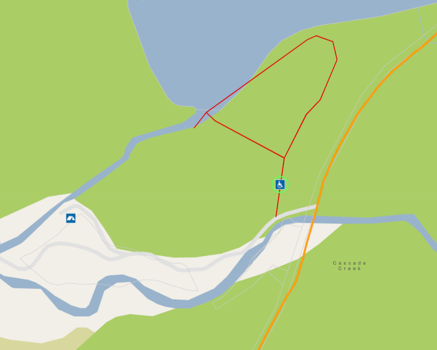
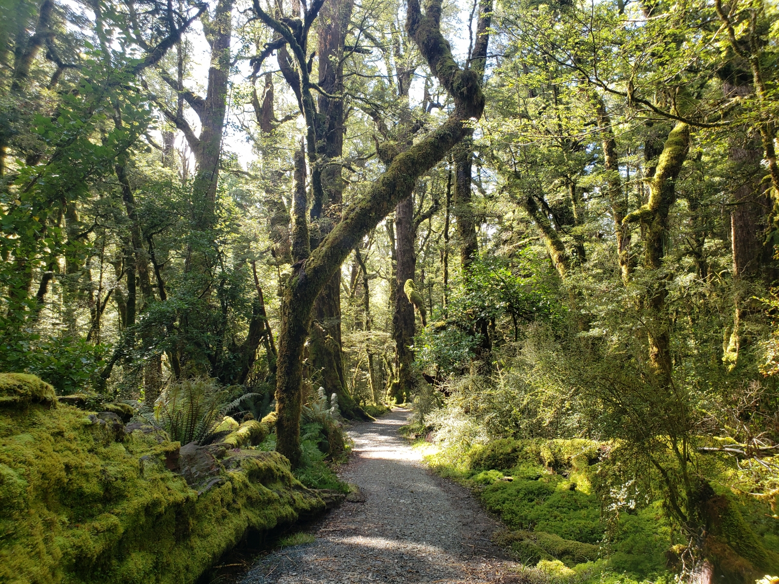
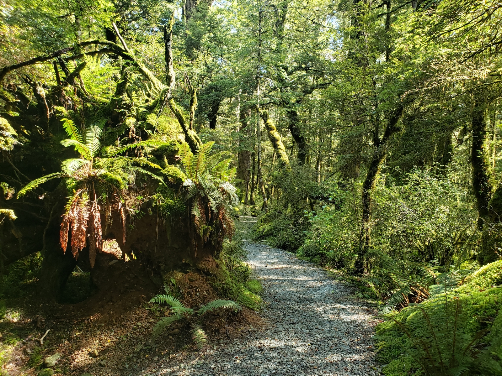
- Lake Gunn Nature Walk (1.4km, 45 minutes, looped): Located at Cascade Creek Campgrounds, this gravel trail is wide and barrier-free. One vaulted toilet in the campgrounds is wheelchair accessible. Since this track is located near camping, it’s common for campers to use this trail in the mornings and evenings, so for less traffic, plan to hike during the day. Take a long, leisurely stroll through the Fiordland forest to Lake Gunn and immerse in nature. Many sections of the trail are thick with gravel, making it a tough hike for manual wheelchairs; many wheelies or power assistance required.
- Knobbs Flat is a historic rest area that is commonly used by visitors daily. Stop here for wheelchair accessible flush toilets.


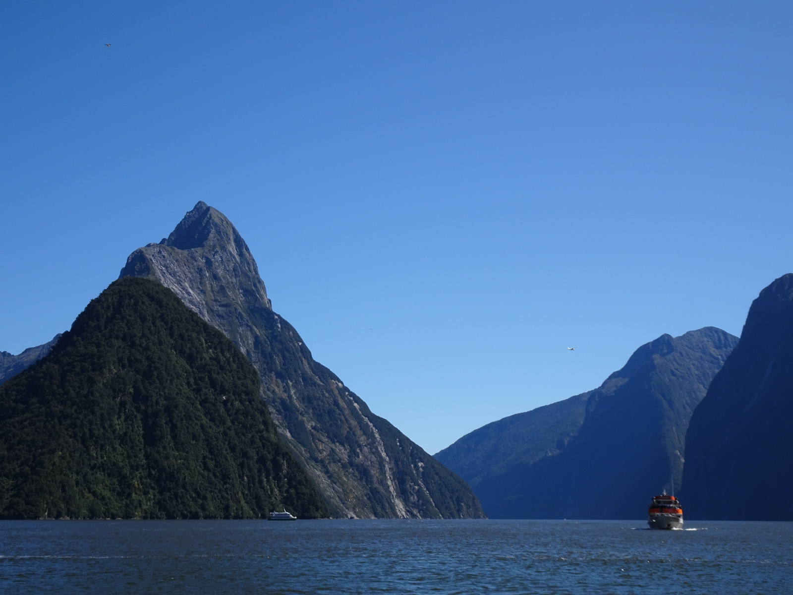
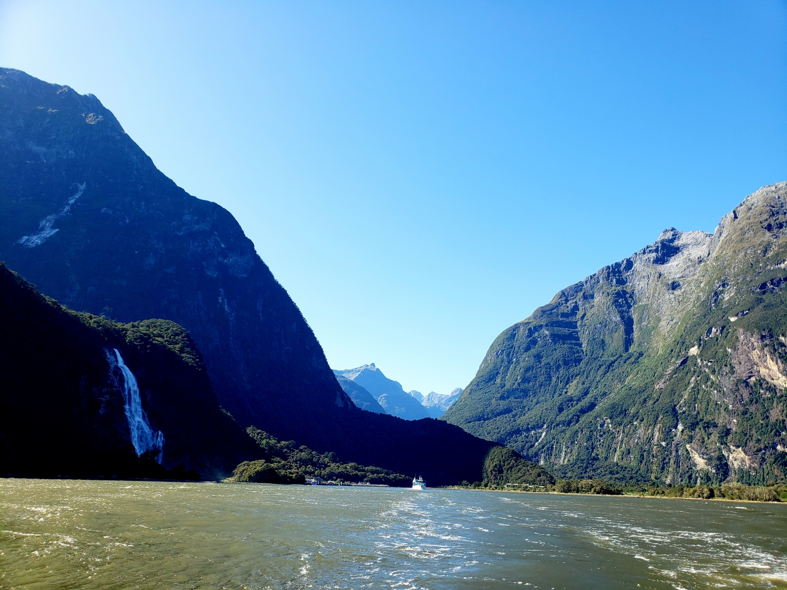


The Milford Sound @ Fiordland National Park
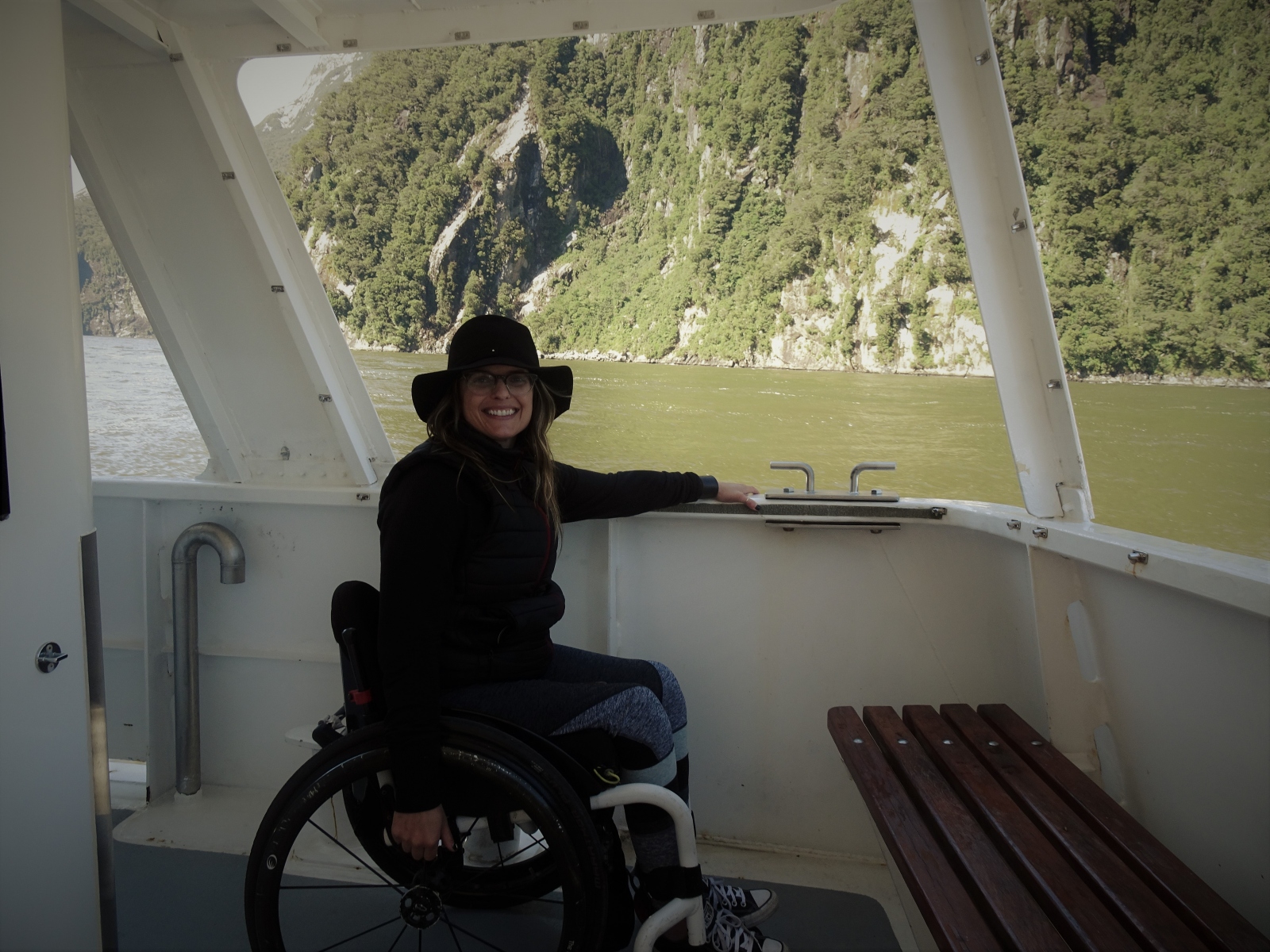
The Milford Sound in Fiordland National Park is a UNESCO World Heritage site and known to some as the 8th Natural Wonder of the World. Visiting Milford Sound, requires advance planning to visit because it’s a challenge to reach; from Te Anau it is three hours away and around six hours from Queenstown. Due to the delicate nature of the environment and immense popularity of this site, the road to Milford Sound is restricted to electric vehicles with a special access permit, mainly buses, and no acceptations are made; many vehicles are forced to turn around at a stop called The Divide. Organizing proper transportation in advance is the only way visitors can experience the Milford Sound. If you have a manual wheelchair and are able to transfer out of it, consider touring Milford with Nigel at Envy Experiences.
After passing the signal light at The Divide, the road descends downhill and becomes windy and narrow, and at one point passes through Homer Tunnel. A large section of the road has been destroyed, forcing a highly-orchestrated production of scheduled vehicles crossings up and down the mountain; missing the scheduled time to go means prolonging the drive another four hours. Besides driving to Milford Sound and getting on a cruise boat, the other popular way to explore this area is by air in a helicopter or small airplane, and there are many companies to choose from, as long as you can transfer out of the wheelchair; no adaptive boarding equipment.
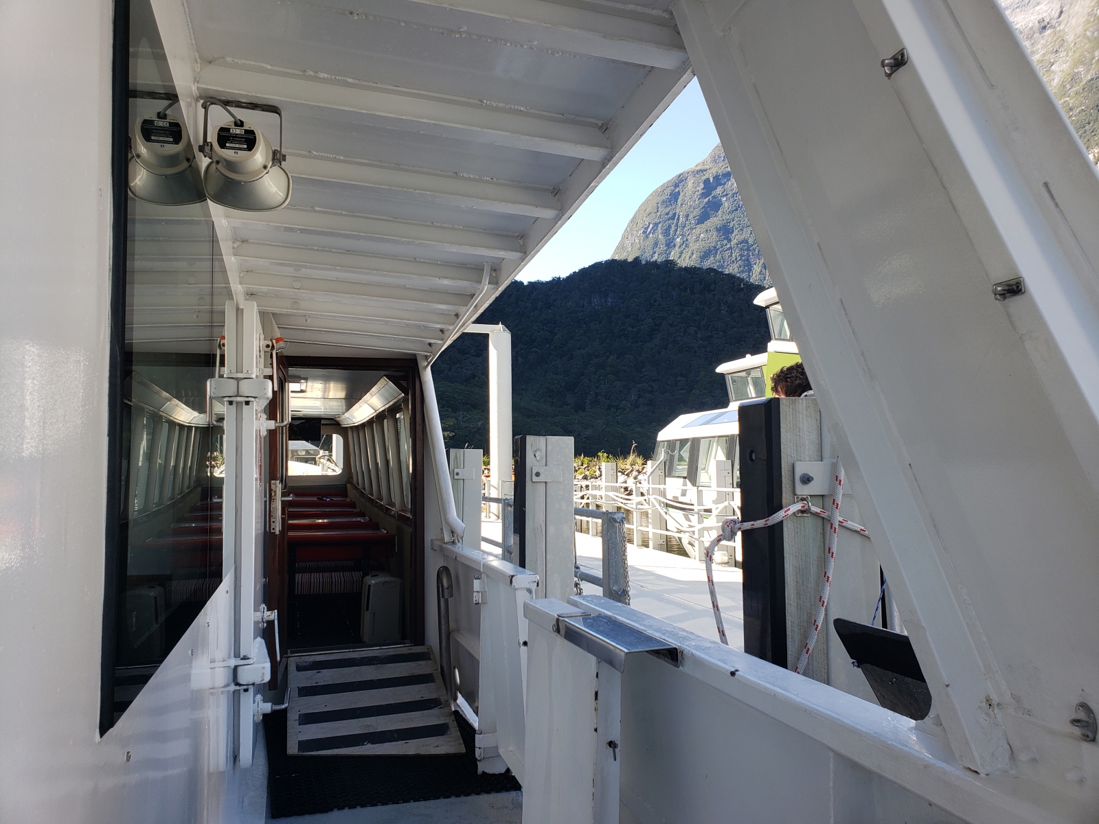
Milford Sound Visitor Cruise Terminal
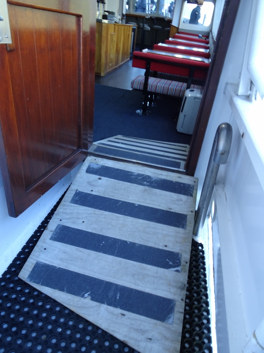
Two wheelchair accessible parking spots near the terminals doors as for loading and unloading; the main parking lot is at least a ten-minute stroll away on a smooth walkway. The entrance, ticketing area and dock all have barrier-free access. Wheelchair accessible toilets are available inside terminal. A number of cruise boats use ramps to get passengers with wheelchairs on and off, along with space at a table inside the cabin and access to the stern outside.
Cruise Milford and Southern Discoveries are examples of boats that have created access for wheelchairs; no onboard accessible toilets. Real Journeys is another Milford cruise option and has an accessible bathroom, but ironically the boat isn’t wheelchair friendly. Only passengers with some mobility are recommended to ride with Real Journeys because of the steep entrances and lack of ramps. When planning a cruise, a lunch or dinner package may be offered, which usually consists of a buffet-style setup. For the best selections and prices, bringing your own food is recommended; a small selection of beverages, snacks and treats are available for purchase on the cruise, and there are no food vendors at the terminal or in the park in general.
- The Chasm Walk (400m, 20 minutes, one-way): After you pass through the tunnel, there are more photo opportunities at The Chasm Walk. From the parking lot, a firm and barrier-free gravel track leads to a bridge with a scenic view of the Cleddau River; A couple of sections of the track are a boardwalk. Along the short hiking trail are waterfalls, showing how much rainfall Milford Sound gets. During the wetter months, this trail is closed for safety. One section of the trail has a small slope, but overall, the trail is relatively flat.
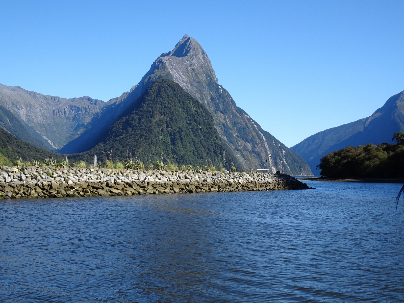
- Piopiotahi Milford Foreshore Walk (400m, 30 minutes, looped): Right at the entrance to the main visitor parking lot at Milford Sound, you will find the start of this walk. It is an easy stroll along the shoreline on a firm and wide trail with views of Mitre Peak. Sandflies are particularly active along this trail, so bring repellent just in case.
- Pop’s View Lookout: For a stunning view of the Hollyford valley on the return trip from Milford Sound stop at Pop’s View. Designated wheelchair-friendly parking isn’t available, but the one of metal platforms is barrier-free.
Last updated on November 1, 2025